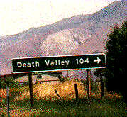
As a child, I remember watching a programme on TV that explained that it was so hot in Death Valley, you could fry eggs on the bonnet of the car.
Such an idea fascinated me, particularly when you consider that anything over about 85°F is considered a "scorcher" in England*, so the idea of it being hot enough for egg frying was more or less the equivalent of walking on the moon.
Anyway. Despite my attempts to steer us in that direction on our Utah trip last summer, we still hadn't made any attempts to go egg frying.
So, in honour of my 30th birthday (glurk) and the fact that the weekend after my birthday is always "Pinkster" (Whitsun? Pentecost?) and must be celebrated (well, it is the weekend after/of my birthday), we made our plan.
We decided to take the Red Car, because although the car's a/c wasn't actually working, we were sure we could get it fixed before we left. In the event, it was fixed four days after we got back. [Ah. Yes. But you can't carry a massive cooler and a barbie on the back of a bike...]
We were going to leave as early as we could sneak out from work on Thursday afternoon. Unfortunately, this plan was completely wrecked by Patrick having to go to Fresno, which is ~200 miles in the wrong direction. Plus, after driving 400 miles, he wasn't as eager as he could have been to hop in the car and go another 250, or so, over the mountains.
So we planned to leave bright and early on Friday morning.
"Bright and early" turned out to be somewhere near midday-ish, but what did we care, eh? We were on holiday. We packed up the car, strapped the bicycles on their new rack (birthday present #1) to the back of the car and hopped in all expectant-like.
Lots of key turning resulted in silence emanating from the car, and we realised that we'd run out of petrol outside our own house. (Patrick optimistically tried to go the 400+ mile round trip to Fresno on one tank of petrol, and then backed the car up our sloping driveway. Oh).
People are always making fun of FIAT electrics, but its electric petrol pump comes in handy for petrol syphoning. We soon hopped back in the Red Car and finally got out of our driveway.
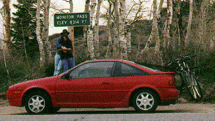
Needless to say, bearing in mind this trip was dubbed our "Summer Holiday", it rained almost the entire time we went over the Sierra. Up hw-50, over Luther Pass, along hw-88 and over Monitor Pass.

Bodie was once a thriving gold mining town of 10,000 people. It is estimated that the mines in the area produced in the region of $90 - $100 million worth of gold bullion. Blinkin'.
However it was not considered the best place in the world if you wanted to live in quiet suburbia. The town boasted 65 saloons and people used to shoot each other a lot. [Incidentally, strangely enough, if you try looking up Bodie on Yahoo, it gives you the prices of prostitutes in Nevada]. One young girl wrote in her diary:
"Goodbye God, I'm going to Bodie..."
This was later retranslated as being:
"Good. By God, I'm going to Bodie..!"
So who knows.
To power the mines, someone came up with the jolly good idea that electricity ought to be able to be transmitted over wires from a distance. So a hydroelectric plant was built 13 miles away on Green Creek, just above Bridgeport, and in November 1892, Bodie became the first place to have a motor operated over long-distance power lines. They made sure they installed the poles in a straight line, because they were worried that electricity would not be able to go round corners.
After its heyday in the 1880s, Bodie suffered several fires and eventually people got fed up and left.
Nowadays there is about 5% of the original town remaining, and Bodie is kept in a state of "arrested decay", which means they stop anything dropping off that might cause an American to sue them should it drop on them.
One of the reasons people weren't keen on the location of Bodie was the fact that it is at about 8000 ft and probably -85°F [*at least*] in the winter and 110°F in the summer.
I can see their point. Like I said, last time I was here was in high summer. This time around, we scurried around, me with a blanket wrapped around my head, Patrick with fifteen jumpers on, until his ears began to hurt from the cold, and we jumped back in the car and bumped back down the gravel road to hw-395.
The whole of Owens Valley and the Eastern side of the Sierra is riddled with hot springs and the like. Long Valley Caldera just happens to be one of the most dubious areas when it comes to "where is going to blow next?".
The US Geological Survey people and the Nevada Seismic network, run by the University of Reno, keep a careful eye on Long Valley. They have 18 seismic stations within the valley and a further 20 within 50km of it. Why, you may ask?
The report goes on to say that there was a minor swarm of some 30 small earthquakes on May 22/23. We went through the area on our return on 20 May.
If you'd like to learn more, you can peer at the information on the USGS page entirely devoted to the subject, including some jolly maps showing the latest seismic activity.
Long Valley Caldera sits at the foot of the only road which runs up to Mammoth Lakes ski resort - one of the most popular for Los Angeles because it's closest. I watched a programme on the TV where they discussed how, if it blew, there would be no way that they could get all the happy skiers down from the resort, seeing as they are up there in their thousands and the road is just not wide enough.
I wondered about the people who'd built their rather fine looking houses on stilts on the edge of the ravines running next to hw-395. Perhaps that's the safest place, on the rock, but I think, given the choice, and watching the regular earthquake activity just there, I'd pick a different spot for my retirement.
Sobering thoughts...
The motel we picked happened to have a herd of birds in their reception, including a macaw, two pushy and bolshy conures, a lorikeet and a lovebird. Good choice.
Bishop has two major "good things" in it - an English red telephone box (don't ask me why) and a bakery called "Erick Schat's Bakkerij" - presumeably run by a dutchman and actually sold good bread!!!! This is the first time I've had good bread in this country since I arrived over two years ago. I even went as far as to buy some of their bread mix, so that I could have some at home. I wish they shipped.
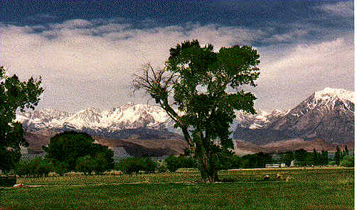
Bright and refreshed the following morning, we made haste down Owens Valley. The Valley floor is at just under 4000 ft and the mountains rise either side to anywhere between 10,000ft and 14,000 ft, so it is pretty spectacular.
I watched this really crap film once, a true story all about this plane crashing on top of the mountain range, just over from Independance, and this woman had to climb all the way to the bottom of the valley to save herself. At the time, it seemed pretty crap. Why didn't she just walk down? But looking at the steep, rocky sides of these mountains, I can see why she might have had minor difficulty.
This is also supposed to be a resort... no, not a resort,... what's the word? (Lucy's brain addles contentedly in the quiet haze of Friday evening beer) A reserve. That's it. A reserve for California big horn sheep on the slopes of the eastern Sierra that butt up to Owens Valley.
Disappointingly, we didn't see any, though, despite Patrick keeping his eyes peeled.
The shy big horn sheep haven't done terribly well in the face of the advancing marauding "white man". They only get to live in a very small part of the State and eat cacti.
[Digression begins]
They have done better, however, than the pronghorn antelope, which used to winter in the western Mojave desert, in Antelope Valley, above smoggy Los Angeles:
[Digression ends]
Anyway.
Once we got down the south end of the valley, we began the great "Mount Whitney spotting game". Being the highest mountain in the contiguous United States at 14,494 ft, you'd think it might be easy to spot? Nah. At Lone Pine, we asked a lady in the supermarket (when we stopped to buy watermelon flavoured bubblegum) [an important necessity when going into the far desert]. She described it to us and told us we would be able to see it from the exit.
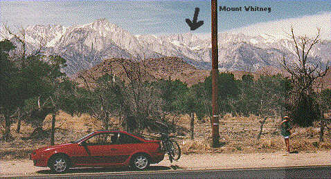 We looked, but couldn't.
So we drove down to rangers' station and looked at their "how to spot Mount Whitney" picture. And looked. And looked at the picture. And looked...
It's not that obvious, really, is it?
That's me, on the right, eating an apple. Also a necessity when going to the far desert.
[Don't ask me why this picture is all faded until you get to the right hand side of it. I have no idea what I did to it. I suppose you want me to go back and scan it again, don't you? Well I'm not gonna...] [Crossing her arms, she says "I don't think so". Ed]
26 July 1996
rev. 13 October 1996
revamped 22 August 2003