 Because
some friends were borrowing Savannah (blessed with her back seat for
their m-i-law
to sit in), we took the big White Truck on its Thanksgiving holidays.
Because
some friends were borrowing Savannah (blessed with her back seat for
their m-i-law
to sit in), we took the big White Truck on its Thanksgiving holidays.
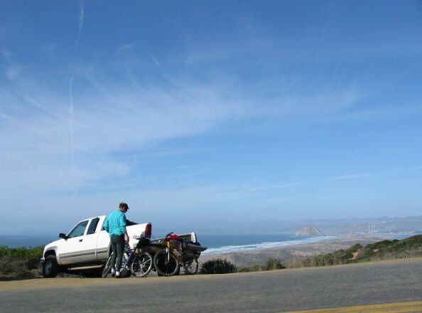
Here is is, parked at the trailhead at Montana de Oro while we unload our steeds.
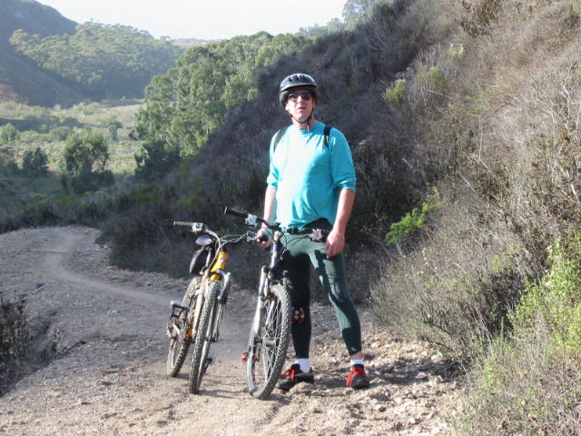 On
the way up the hill on the Manzanita Trail. Predictably, I was
already off and walking. The sea is behind us.
On
the way up the hill on the Manzanita Trail. Predictably, I was
already off and walking. The sea is behind us.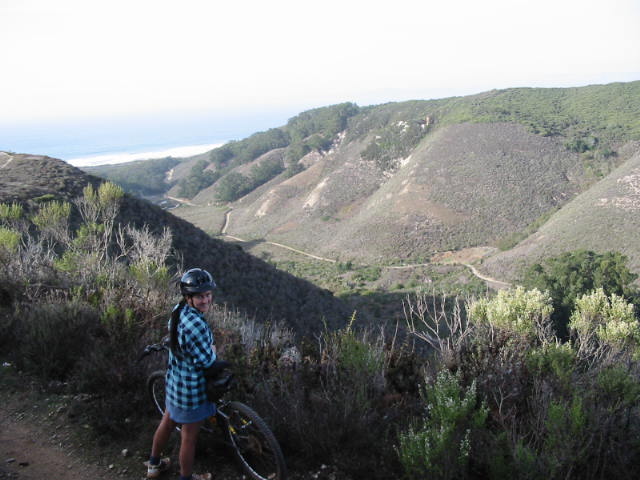 Looking
back the way we've just come. We rode up the hill, then made a switchback
across the canyon and back up along the opposite side. You can see the Manzanita
Trail we just came up, down in the sunny part of the canyon.
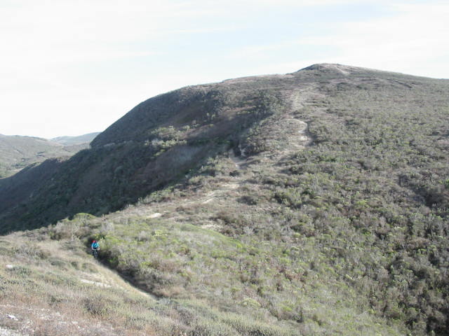
Looking
back the way we've just come. We rode up the hill, then made a switchback
across the canyon and back up along the opposite side. You can see the Manzanita
Trail we just came up, down in the sunny part of the canyon. We
took a spur trail to look over down to where the horse camp is in the
bottom of this canyon over near the sea.
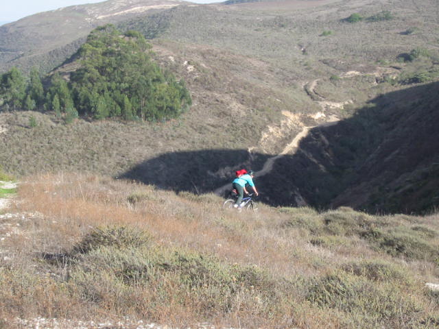
We
took a spur trail to look over down to where the horse camp is in the
bottom of this canyon over near the sea.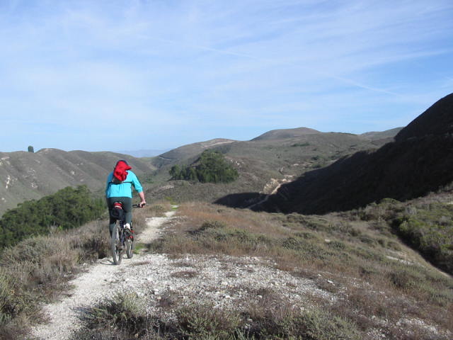 Cycling
back towards the main trail.
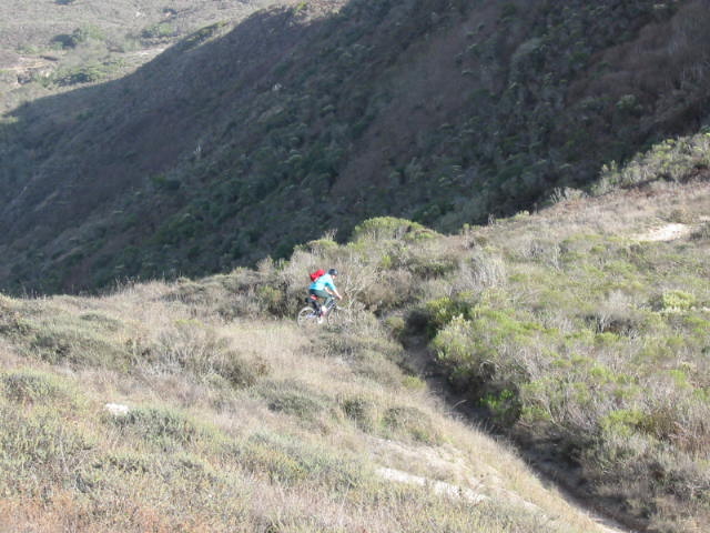
Cycling
back towards the main trail.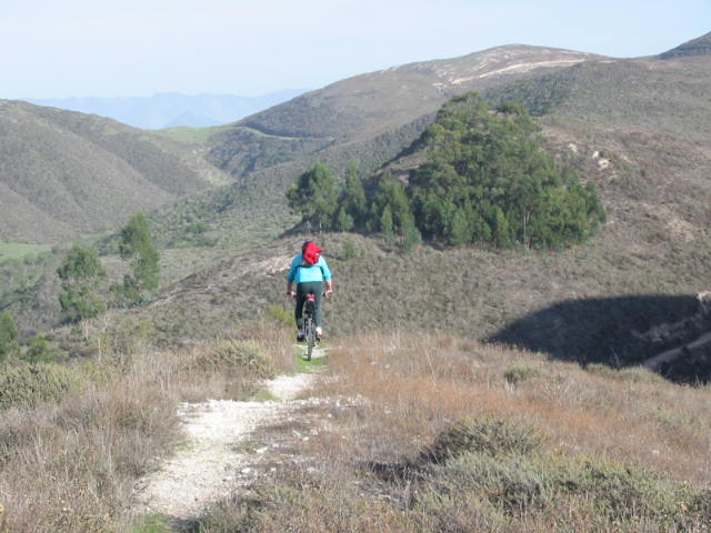
 Unbeknownst
to us when we took these photos, by an interesting quirk of fate, we ended
up having to go up that hill on the right...
Unbeknownst
to us when we took these photos, by an interesting quirk of fate, we ended
up having to go up that hill on the right...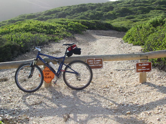 ...after
discovering that "Not a Through Trail" means what it says, and
yes, indeed, the Bloody Nose Trail is closed (and has been, my
friend reports, for about 18 months). :-(
...after
discovering that "Not a Through Trail" means what it says, and
yes, indeed, the Bloody Nose Trail is closed (and has been, my
friend reports, for about 18 months). :-(
That would explain why the trail was so overgrown. I'm still nursing the bramble scratches and poison oak oozes.
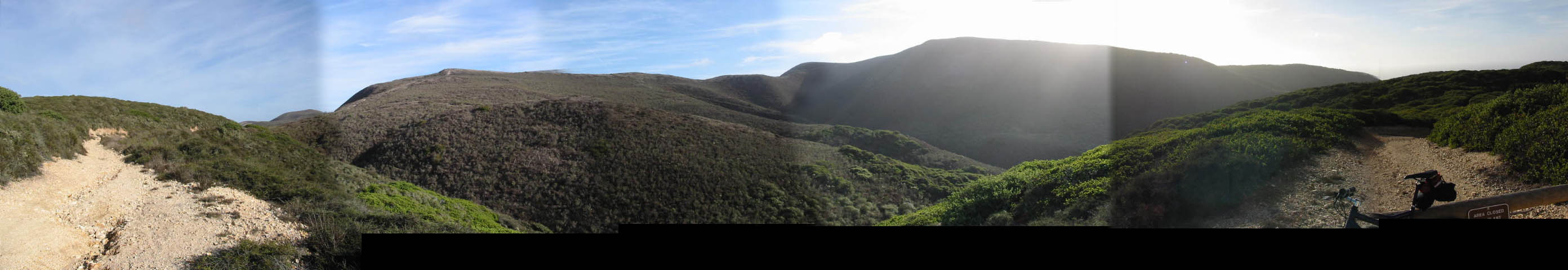
Below is the 180° view looking over towards the Ridge Trail that we now have to go up. That's Hazard Peak with the sun behind it:
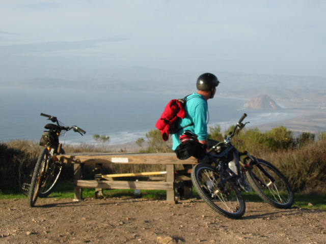
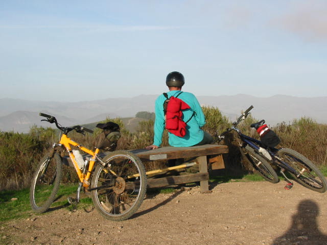
 Looking
over at Morro Bay.
Looking
over at Morro Bay.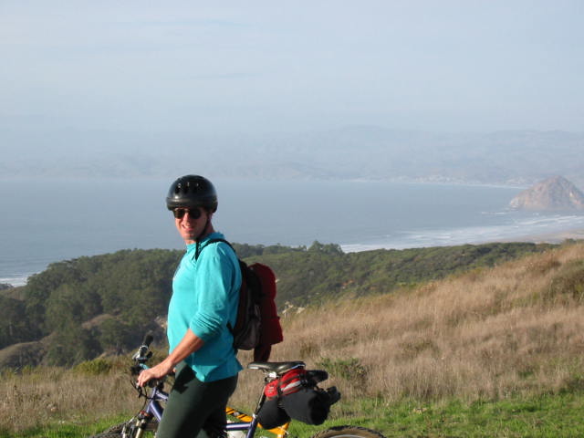 T'were
pretty.
T'were
pretty.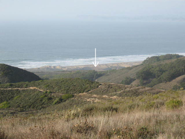 And
there's our White Truck on its holidays by the sea - that tiny white dot
shown by the arrow, down at the trailhead four miles away.
And
there's our White Truck on its holidays by the sea - that tiny white dot
shown by the arrow, down at the trailhead four miles away.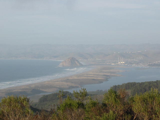 Morro
Bay again.
Morro
Bay again.
Patrick's mum lives about 20 miles north along the coast in Cambria.
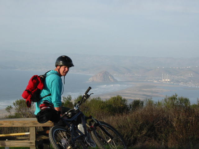
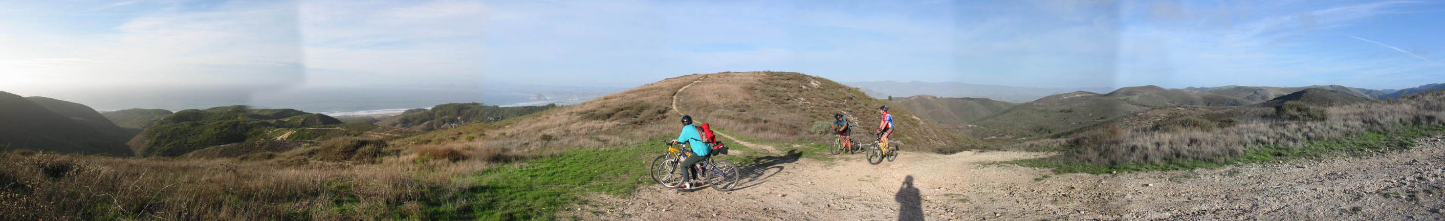
 And
here's the view from the very top, Hazard Peak, at 1076' - well worth the
effort - not least because then you get to do the twisty downhill part
that was WILD!
And
here's the view from the very top, Hazard Peak, at 1076' - well worth the
effort - not least because then you get to do the twisty downhill part
that was WILD! Back
at the truck again, after cycling the last 2 miles uphill. Tired legs and
knees.
Back
at the truck again, after cycling the last 2 miles uphill. Tired legs and
knees. We
can see the sea.
We
can see the sea.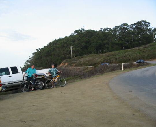 Yes,
the road does actually tilt that way.
Yes,
the road does actually tilt that way.
Patrick and Lucy - proud owners of the White Truck and our bikes.

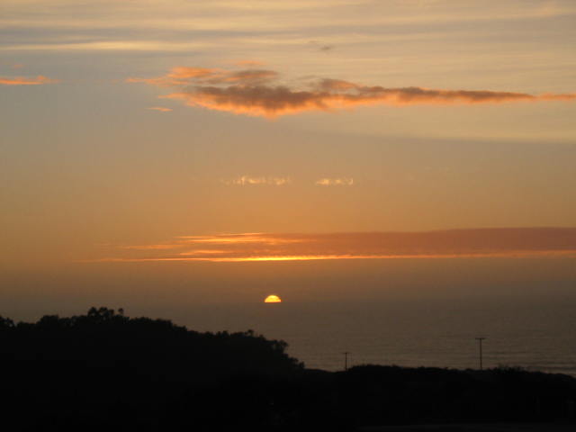 Sunset
as we were leaving the park.
Sunset
as we were leaving the park.